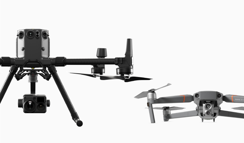
| M300 RTK |
Specs/Features |
| Diagonal Wheelbase |
895mm |
| Packing Box Size |
735mm×591mm×342mm |
| Dimensions(Folded, propellers included) |
430mm×420mm×430 mm
|
| Max Takeoff Weight |
9 kg
|
| Max Payload |
2.7 kg
|
| Hovering Accuracy (GPS) |
Vertical=± 0.5 m, Horizontal=± 1.5 m |
| Hovering Accuracy (Downward Vision) |
Vertical=± 0.1 m, Horizontal=± 0.3 m |
| GNSS |
GPS+GLONASS+BeiDou+Galileo |
| RTK |
The aircraft supports RTK positioning and orientation capabilities, and can fly safely in an environment where the compass is interferenced. |
| Hovering Accuracy (RTK) |
Vertical=± 0.1 m, Horizontal=± 0.1 m |
| Max Ascent Speed |
6 m/s
|
| Max Descent Speed |
5 m/s
|
| Max Descent Speed (tilt) |
7 m/s
|
| Max Speed |
23 m/s
|
| High Altitude Propeller |
Aircraft supports to be equipped with High Altitude Propeller, can fly in high altitude application scenarios with low flight noise. |
| Max Service Ceiling Above Sea Level |
7000 m (with 2195 propellers) |
| Max Wind Resistance |
15 m/s
|
| Max Flight Time (without payload) |
55 min
|
| Hardware Architecture Design |
Folding design. Support to be unfolded and taken off in 3 minutes. |
| Operating Temperature |
-20°C to 50°C |
| Vision System |
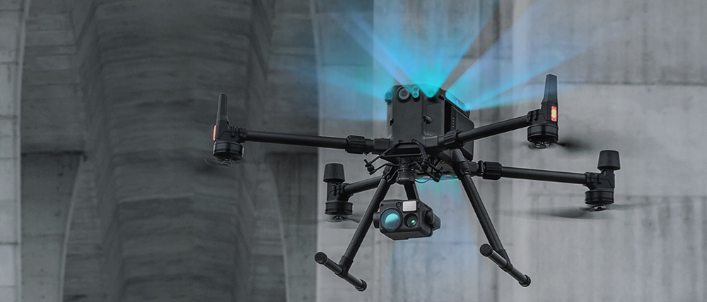
The aircraft is equipped with binocular vision systems on the front, back, up, down, left and right ride. When nearby obstacle is detected, the aircraft can prompt a warning message through the ground station software; When the distance to the obstacle is very close, the aircraft is able to actively brake.
|
| Vision System |
Forward/Backward/Left/Right: 0.7-40m
Upward/Downward: 0.6-30m |
| Infrared ToF Sensing System |
The aircraft supports 6 Directional (front, back, up, down, left and right ride) TOF sensor. |
| Landing protection |
During autonomous landing process, drone can detect the below terrain. When the terrain is uneven ground or water surface, aircraft keeps hovering, and at the same time sends a warning message to the user through the ground station software
|
| Redundancy Sensor |
Aircraft supports dual IMU, dual barometer and dual compass |
| FPV Camera |
The aircraft is equipped with FPV camera, resolution is 960p |
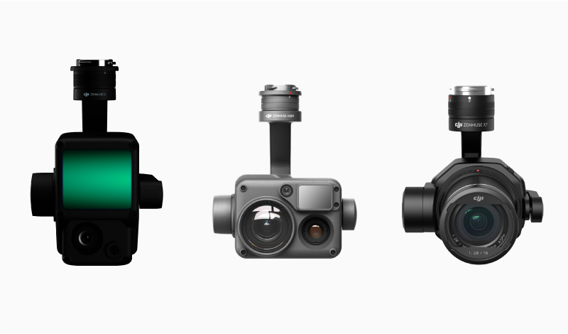
| Dual Downward Gimbals |
Aircraft supports to be equipped with Dual Downward Gimbals |
| Single Upward Gimbal |
Aircraft supports to be equipped with upward gimbal |
| Ingress Protection Rating |
IP45 |
| Beacon |
Support Beacon, and pilot can control the Beacon on-off through App, to improve the flight safety at night |
| Discreet Mode |
Support to turn off arm LEDs to perform covert tasks |
| Encrypted video transmission |
Video transmission link is encrypted by AES-256 algorithm |
| Max Transmitting Distance (unobstructed, free of interference)
|
15 km(FCC)
|
| Video Transmission Resolution |
Support 1080p Video Transmission |
| Dual-band Transmission Link |
Support 2.4GHz and 5.8GHz dual-band transmission link, when one channel is blocked, the aircraft should be able to switch to another channel for transmmission |
| Remote Controller |
|
| Remote Controller |
Remote controller supports to receive FPV camera view and main gimbal camera view simultaneously.
|
| Remote Controller |
The remote controller supports both built-in battery and external replaceable battery
|
| Remote Controller |
The remote controller supports 5.5-inch display screen with a resolution of 1080p, brightness of at least 1000 cd/m2 |
| Remote Controller |
Support to output camera view or remote controller screen view, through HDMI interface
|
| Remote Controller |
Support to connect Android/iOS tablet |
| Software Function |
|
| AirSense |
Able to receive ADS-B broadcast information of civil aviation passenger aircraft, and can send warning message about nearby civil aviation passenger aircraft to user through ground station software |
| Advanced Dual Control |
Aircraft supports to be connected with two remote controllers simultaneously. Both of the two remote controllers can be used to control the aircraft and the gimbal.
The control authority can be flexibly switched between the two remote controllers. Besides, if the aircraft control authority is locked with one remote controller, the other remote controller cannot obtain this authority unless it is unlocked. |
| Primary Flight Display |
The ground station software can display real-time information about aircraft speed, altitude, orientation, and gimbal orientation, etc. |
| Primary Flight Display |
The ground station software can display wind speed and direction in real time |
| Primary Flight Display |
The ground station software can display the map of obstacle in the front, rear, left, and right of aircraft. It support to set obstacle warining distance, and provide voice reminders when there are obstacles within the distance. |
| Hot-swappable Battery |
The aircraft supports hot-swappable batteries. No need to power on and power off the aircraft during battery replacement. |
| Health Management System |
The aircraft can record the total flight time, total flight times, and total flight distance, accumulated from factory date. The records can be viewed through the remote controller APP. |
| Health Management System |
The remote controller APP can display the health status of key aircraft modules and save abnormal records. |
| Waypoint 2.0 |
Mark waypoints on the map, and then edit the waypoint actions and flight route altitude, speed and other parameters to achieve automatic flight. |
| Waypoint 2.0 |
The flight route can be saved as KML file, which can be imported and exported. |
| Waypoint 2.0 |
Waypoint height can be set as absolute height/ relative height |
| Waypoint 2.0 |
Support to take pictures and videos by multiple gimbals, at the same waypoint. |
| Waypoint 2.0 |
It support to add no less than 10,000 waypoints in a single flight route. |
| Waypoint 2.0 |
It supports to record the current position of the aircraft as a waypoint, and set the flight speed and altitude, plan the flight mission. |
AI Spot-Check
|
It supports recording a flight mission through the remote controller APP, frame the object of interest on the photos taken during the flight mission. When the flight mission is executed in next time, the aircraft supports advanced algorithms to detect and find the object of interest and take precise pictures, to realized consistent photo acquisition.
Besides, it supports to check the photos on the remote controller APP. |
| Smart Track |
The aircraft can automatically adjust gimbal, to tack a defined object such as vehicles, people, and boats. Besides, the system can automatically identify vehicles, people, and boats. Pilot can also manually select interest targets. |
| Smart Track |
It supports gimbal follow mode and gimbal free mode. In gimbal follow mode, track the target by adjusting aircraft orientation. In gimbal free mode, track the target by adjusting gimbal orientation. |
| Smart Track |
It supports auto-zoom function, which helps to keep the subject centered in the frame for optimal viewing |
| Smart Track |
Support user to pin a point using laser rangefinder, this point can be shown on the map of remote controller, camera view, FPV camera view, and the map of UAV management platform. It can also be shared to third-party applications. |
| UAV Management Platform |
The aircraft can be connected to UAV management platform. It supports to login the platform, check the position and flight parameters of multiple drones, check the historical flight records, manage drones and fleets. |
| Limit Flight Height and Distance |
Support to set the limitation of flight height and flight distance, through the remote controller APP. |
| Precision Landing |
Support accurately land to take-off point, with one click. |
| Low Battery Return to Home |
The battery level is shown on the ground station software in real time. When the battery level is low, the ground station software can provide warnings, to inform the user to perform return-to-home. If the user does not response within the given time, the aircraft will automatically return home. |
| Battery Level Display |
Support display current aircraft battery level and remaining flight time on remote controller APP. Prompt low battery warning information for user. |
| Failsafe Return to Home |
When the remote controller and aircraft are disconnected during the flight, the aircraft can automatically terminate the flight mission and return to home. During the return flight, if the connection between aircraft and remote controller comes to normal, user can cancel the return to home mission, through the remote controller. |
| ESC Buzzing |
Support to turn on the ESC buzzing function through the remote controller APP, to find the aircraft in unexpected situations. |
| Aerial Photography |
Support to plan aerial photography flight mission through remote controller APP. According to the selected survey area and camera parameters set by the user, the flight mission can be automatically planned by remote controller APP. Pilot can perform the mission for aerial photography. Besides, the flight mission can be saved locally. |
| Aerial Photography |
It supports importing the captured photos into 2D and 3D reconstruction software on the computer, to generate 2D map and 3D model of the photographed area. |
| SDK Capability |
Support development kit for mobile terminal, on-board equipment, and 3rd party payload. It also supports power supply and communication interface, for 3rd party secondary development and integration. |
| Intelligent Battery |
|
| Battery Station |
The battery station should support multiple battery ports to charge up to eight aircraft batteries and four remote controller batteries. |
| Battery Station |
The battery station should be equipped with a portable lever |
| Battery Station |
The battery station is equipped with LED indicator and buzzer to indicate battery status and alarm. |
| Charging Speed |
Charge 2 batteries to full capacity within 1 hour |
| Pairing Batteries |
The aircraft is designed with dual batteries. If two batteries with a significant difference in battery life are installed and powered on, a prompt will pop up in the ground station software, to recommend user to replace the batteries to a pair with similar performance. |
| Dual Battery |
In the event that one battery fails, the drone can still return home safely with the other battery.
|
| Self-discharge |
In the case that the battery power level is high, and its storage time is longer than the Self-Discharge time (can be set as 1 day to 10 days), then the battery will automatically be discharged to 60% in order to protect battery and extend battery life. |
| Battery Level Display |
The battery supports indicator, which can display the current battery level. |
| Overvoltage Charging Protection |
Support overcharge protection function. If the charging voltage is too high, the charging device can disconnect the charging circuit. |
| Overcurrent Charging Protection |
Support overcharge protection function. If the charging current is too large, the charging device can disconnect the charging circuit. |
| Battery Self-heating |
When operating in low-temperature conditions, the battery will automatically warm up after power on if it is installed into the aircraft. |
| Over-discharge Protection |
When the battery voltage drops to a certain value, the battery can stop discharging.
|
| Cell Damage Detection |
If the battery cell is damaged or the cells are seriously unbalanced, groud station software can prompt warning information for user. |


